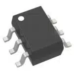
Inertial measurement units, or IMUs, are essential for optimizing drone performance. These systems ensure stability by detecting movements and correcting imbalances in real time. Equipped with sensors like gyroscopes, IMUs enable drones to maintain stable flight even under challenging conditions. Advanced models, such as the Icm-42605, offer precise motion tracking, allowing drones to navigate with exceptional accuracy. By incorporating the Icm-42605 and similar technologies, drones achieve smooth operation and reliable control throughout every mission.
Key Takeaways
-
IMUs use accelerometers, gyroscopes, and magnetometers to track motion. This helps drones stay steady and move correctly.
-
Special algorithms, like the Kalman filter, make IMUs more accurate. They combine sensor data, fix mistakes, and improve navigation.
-
IMUs need regular recalibration to work well, especially on long flights or in areas with strong interference.
-
Drones with IMUs can fly without GPS by using cameras to stay steady and move on their own.
-
The ICM-42605 is an important IMU model. It helps drones stay stable with its accuracy, low energy use, and quick data processing.
Components of Inertial Measurement Units
Accelerometers in IMU Motion Sensors
Accelerometers measure linear acceleration along one or more axes. These sensors detect changes in velocity, enabling drones to understand their movement in 3D space. Modern accelerometers used in drones offer high sensitivity and precision, which are essential for maintaining stability during flight.
Key performance metrics for accelerometers include:
-
Dynamic range: Up to 40g, offering a threefold improvement over typical consumer devices.
-
Noise density: 25 μg/√Hz, providing ten times better noise performance.
-
In-run bias stability: 10 μg, ensuring consistent measurements over time.
|
Accelerometer Parameter |
Typical Industrial Specification |
Improvement Over Typical Consumer Device |
|---|---|---|
|
Dynamic range |
Up to 40g |
3× |
|
Noise density |
25 μg/√Hz |
10× |
|
Velocity random walk |
0.03 m/s/√Hz |
10× |
|
In-run bias stability |
10 μg |
10× |
|
Bias repeatability |
25 mg |
100× |
|
–3 dB bandwidth |
500 Hz |
2× |
These specifications highlight the advanced capabilities of accelerometers in IMUs, making them indispensable for drone stability and motion tracking.
Gyroscopes for Angular Velocity Detection
Gyroscopes measure angular velocity, allowing drones to detect rotational movements. This capability is crucial for maintaining orientation and executing precise maneuvers. High-performance gyroscopes minimize drift and noise, ensuring accurate data even in dynamic environments.
Performance metrics for gyroscopes include:
-
Bias instability: Reduces drift, critical for high-precision applications.
-
Noise density: Distinguishes real movements from random fluctuations.
-
Sample rate: Captures fast-moving events, essential for drones operating at high speeds.
By integrating gyroscopes with accelerometers, IMUs provide comprehensive motion data, enabling drones to maintain balance and execute complex flight patterns.
Magnetometers for Orientation and Heading
Magnetometers measure the Earth’s magnetic field to determine orientation and heading. These sensors play a vital role in navigation, especially in GPS-denied environments. However, UAV-induced magnetic noise can affect their accuracy.
To improve precision, magnetometer configurations must account for:
-
UAV-induced magnetic noise rather than ambient field changes.
-
Sensor orientation and bi-directional flight modes, which can cause heading errors.
-
Wind-induced oscillations, which impact data quality.
|
Observation |
Description |
|---|---|
|
Heading Error |
Strong heading error observed due to sensor orientation and bi-directional flight mode, influenced by wind conditions. |
|
Oscillation Effects |
Wind caused oscillations in the suspended magnetometer, affecting data quality and stability. |
|
Sensor Configuration |
Improved stability achieved by modifying the support structure of the magnetometer to reduce oscillations. |
By addressing these challenges, magnetometers enhance the drone’s ability to navigate accurately in various conditions.
Integration of Components in IMUs
The integration of accelerometers, gyroscopes, and magnetometers within an IMU creates a unified system capable of delivering precise motion data. Each sensor contributes unique measurements, but their combined output provides a comprehensive understanding of a drone’s movement and orientation.
Sensor fusion plays a critical role in this integration. Algorithms like the Kalman filter or Madgwick filter process data from all three sensors to enhance accuracy and reduce errors. For example:
-
Accelerometers measure linear acceleration, but their readings can be affected by vibrations.
-
Gyroscopes detect angular velocity, yet they are prone to drift over time.
-
Magnetometers provide heading information, though they can be influenced by magnetic interference.
By combining these inputs, sensor fusion algorithms correct individual sensor limitations and deliver reliable motion estimates.
Tip: The Kalman filter is particularly effective in complex applications like drone navigation. It incorporates external data, such as GPS signals, to improve accuracy and robustness.
Frequent recalibration further enhances IMU performance. Small errors in sensor measurements can accumulate over time, leading to drift. Recalibration and the integration of external systems, such as GPS, help manage this issue. This ensures that drones maintain stable flight and accurate navigation, even during extended missions.
The seamless integration of these components allows IMUs to provide real-time data essential for drone stability and motion tracking. This synergy ensures that drones can operate effectively in diverse environments, from open skies to GPS-denied areas.
How IMUs Work in Drones
Sensor Fusion and Motion Estimation
IMUs play a pivotal role in drones by combining data from multiple sensors to estimate motion accurately. This process, known as sensor fusion, integrates inputs from accelerometers, gyroscopes, and sometimes magnetometers. By merging these data streams, drones can determine their position, orientation, and velocity in real time.
Key components of sensor fusion include:
-
3-axis accelerometers and gyroscopes: These sensors provide essential data for stable flight.
-
Integration with GPS: This enhances navigation, especially for dead reckoning in areas with limited GPS signals.
-
Redundancy through multiple IMUs: Using more than one IMU improves accuracy and reliability, particularly in GPS-denied environments.
Note: Sensor fusion algorithms, such as the Kalman filter, are critical for processing this data. They reduce errors and ensure smooth operation, even in dynamic conditions.
|
Parameter |
Value |
|---|---|
|
IMU Data Publishing Rate |
|
|
Maximum Velocity |
±0.4 m/s |
|
Maximum Acceleration |
±0.4 m/s² |
|
Camera Resolution |
0.1 m |
|
Visual Inflation Distance |
0.2 m (0.5 * h_w) |
|
Success Rate in Navigation |
60% |
|
Obstacle Spacing |
2 * h_w |
This table highlights the performance metrics of IMUs in drone navigation, showcasing their importance in achieving precise motion estimation.
Algorithms for Processing IMU Data
Processing IMU data in drones requires advanced algorithms to interpret sensor readings and provide actionable insights. These algorithms analyze data from gyroscopes and accelerometers to calculate orientation, angular velocity, and linear acceleration.
Key algorithms include:
-
Keyframe creation: Identifies significant frames for mapping and navigation.
-
Frame tracking: Tracks the drone’s position relative to keyframes, ensuring real-time responsiveness.
-
Loop closure techniques: Corrects drift by revisiting previously mapped areas.
|
Evidence Type |
Description |
|---|---|
|
Sensor Fusion Techniques |
The integration of visual, depth, LiDAR, and IMU data enables accurate mapping and navigation in confined spaces. |
|
Motion Estimation Algorithms |
Algorithms initialize odometry and pose estimation, combining IMU and camera data for precise navigation. |
|
Performance Metrics |
Achieves navigation accuracy of 0.4 meters and mapping quality with an RMSE of 0.13 m. |
|
Reconstruction Accuracy |
Demonstrates 97% accuracy at close distances, with a gradual decline at longer ranges. |
These algorithms ensure drones can navigate complex environments with high precision, making them indispensable for both indoor and outdoor applications.
Overcoming Challenges like Drift and Noise
Drift and noise are common challenges in IMU data, but modern drones employ innovative methods to address these issues. Drift occurs when small errors in sensor readings accumulate over time, while noise refers to random fluctuations in data.
To overcome these challenges, drones use:
-
Fault Detection and Isolation (FDI) systems: These systems quickly identify and isolate faults, ensuring robust performance.
-
Sensor fusion algorithms: These algorithms combine data from multiple sensors to minimize the impact of noise and drift.
-
Recalibration: Regular recalibration helps maintain accuracy during extended missions.
|
Key Features of FDI System |
Description |
|---|---|
|
Fast Detection |
Quickly identifies abnormal situations. |
|
Isolation of Faults |
Effectively isolates faults. |
|
Robustness to Noise |
Handles noise and uncertainties. |
|
Low False Alarm Rate |
Minimizes false alarms during operation. |
By implementing these strategies, drones achieve reliable performance, even in challenging environments. The integration of gyroscopes with advanced algorithms ensures accurate motion tracking and stable flight.
IMUs and Drone Stability
Maintaining Balance with IMU Motion Sensors
IMU motion sensors play a vital role in maintaining a drone’s balance during flight. These sensors continuously measure linear acceleration, angular velocity, and magnetic field direction, providing real-time data to the flight control system. This data enables the drone to adjust its motor speeds and control surfaces to counteract sudden changes, such as gusts of wind or rapid directional shifts.
The integration of IMU sensors in drones is crucial for maintaining balance during flight. These sensors provide real-time data acquisition and filtering techniques that help stabilize the aircraft against sudden changes, such as gusts of wind. The IMU consists of accelerometers, rate gyroscopes, and magnetic field sensors, which work together to measure linear acceleration, angular velocity, and the direction of the magnetic field. This data is essential for the flight control system to issue timely commands for motor and control surface adjustments, ensuring stable flight.
IMU motion sensors also enable drones to hover steadily, even in challenging conditions. By combining data from accelerometers and gyroscopes, the flight controller can detect and correct imbalances instantly. This capability ensures that drones maintain their intended position and orientation, whether they are performing complex maneuvers or holding a fixed position in the air.
Countering External Disturbances
External disturbances, such as wind, turbulence, or sudden environmental changes, can destabilize a drone during flight. IMU motion sensors counter these disturbances by delivering real-time data on the drone’s orientation and velocity. This information allows the flight controller to make rapid adjustments, ensuring the drone remains stable and responsive.
-
IMUs collect real-time data on movement and orientation, crucial for stability in windy conditions and sudden maneuvers.
-
Gyroscopes detect changes in angular velocity, allowing the flight controller to make instant adjustments to maintain stability.
-
The combination of IMUs and gyroscopes enables drones to hover steadily and follow pre-programmed flight paths accurately, enhancing navigation and flight autonomy.
For example, when a gust of wind pushes a drone off course, the IMU detects the change in orientation and velocity. The flight controller then uses this data to adjust motor outputs, counteracting the disturbance and restoring the drone’s original trajectory. This rapid feedback loop ensures that drones can operate effectively, even in unpredictable environments.
Enhancing Flight Control and Orientation
IMUs significantly enhance a drone’s flight control and orientation by providing precise data on its position and movement. These sensors use quaternion representation to track orientation accurately, enabling the drone to execute smooth transitions and maintain level flight.
|
Aspect |
Description |
|---|---|
|
Quaternion Representation |
IMUs provide orientation information in quaternions, ensuring accurate tracking of the drone’s orientation. |
|
Attitude Stabilization |
IMU data on angular rates helps stabilize and control the drone’s orientation by adjusting motor speeds. |
|
Control Feedback Loop |
IMU data is used in a feedback system for real-time adjustments to motor outputs, ensuring stable flight. |
|
Low-Level Stabilization |
IMUs maintain level orientation and compensate for disturbances, enabling smooth flight transitions. |
IMU motion sensors also improve the drone’s responsiveness to commands. By correcting sensor biases, these systems minimize errors in orientation and movement. This leads to better stability and reduces erratic behavior during flight. Enhanced accuracy and stability allow drones to perform complex tasks, such as navigating tight spaces or capturing high-quality aerial footage, with greater precision.
Tip: Regular calibration of IMU motion sensors ensures optimal performance, especially during extended missions or in environments with high levels of interference.
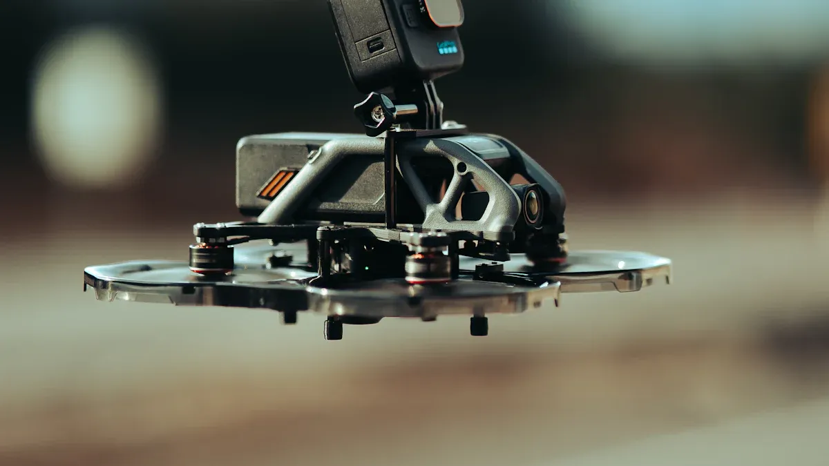
Role of the ICM-42605 in Drone Stability
The ICM-42605 plays a pivotal role in enhancing drone stability by delivering precise motion data to flight control systems. This advanced inertial measurement unit combines a 6-axis gyroscope and accelerometer, enabling drones to detect and respond to changes in orientation and movement. Its compact design and high-performance capabilities make it ideal for drones operating in dynamic environments.
Key Features of the ICM-42605
The ICM-42605 offers several features that contribute to drone stability:
-
Low Power Consumption: Optimized for energy efficiency, it supports extended flight durations.
-
High Precision Sensors: The gyroscope and accelerometer provide accurate measurements, reducing drift and noise.
-
Fast Data Processing: Its high output data rate ensures real-time responsiveness during flight.
These features allow drones to maintain balance, counteract disturbances, and execute complex maneuvers with precision.
Companion and Supporting Chips
The ICM-42605 often works alongside companion chips to enhance its functionality. These chips process data, manage power, and support communication:
-
MCUs/SoCs:
-
Wireless Communication Chips:
-
QN9080 and CC2642R provide Bluetooth LE capabilities.
-
BCM4343W integrates Wi-Fi and Bluetooth for embedded systems.
-
-
Power Management ICs:
-
TPS7A02 and RT9080 ensure efficient power delivery to sensors.
-
-
Sensor Fusion/AI Accelerators:
-
Bosch BHI260AP and CEVA-BX1/BX2 offload motion processing tasks, improving system efficiency.
-
These supporting components enhance the ICM-42605’s performance, ensuring drones operate reliably in diverse conditions.
Advanced Applications in Drone Stability
The ICM-42605 enables drones to achieve stability in challenging scenarios. Its precise motion tracking allows drones to hover steadily, even in turbulent air. By integrating sensor fusion algorithms, the ICM-42605 combines data from accelerometers and gyroscopes to deliver accurate orientation and velocity measurements.
For example, when a drone encounters sudden wind gusts, the ICM-42605 detects the disturbance instantly. The flight controller uses this data to adjust motor speeds, restoring balance and maintaining the drone’s trajectory. This rapid feedback loop ensures stable flight and enhances navigation accuracy.
Related Motion Sensor Alternatives
The ICM-42605 belongs to a family of high-performance motion sensors. Other variants include:
-
InvenSense Family Chips:
-
ICM-42688-P offers higher precision for industrial applications.
-
ICM-20689 provides a higher output data rate for demanding tasks.
-
MPU-6050 remains a popular choice for basic applications.
-
-
Competitor Chips:
These alternatives highlight the versatility of motion sensors in drone technology, but the ICM-42605 stands out for its balance of precision, efficiency, and compact design.
Tip: Pairing the ICM-42605 with advanced sensor fusion algorithms, such as the Kalman filter, further enhances drone stability and motion tracking.
The ICM-42605’s integration into drones ensures reliable performance, making it a cornerstone of modern UAV technology.
IMUs and Motion Tracking in Drones
Tracking Movement in 3D Space
IMUs enable drones to track movement in 3D space by combining data from accelerometers, gyroscopes, and magnetometers. These sensors provide critical information about direction, speed, and gravitational forces, allowing drones to calculate their position and orientation accurately. By leveraging sensor fusion algorithms, drones can process this data to achieve precise motion planning and stabilization.
Robotic experiments have demonstrated the effectiveness of IMUs in autonomous flight. These tests show that drones can rely on optic flow and gyro measurements to navigate complex environments without external assistance. Additionally, IMUs help mitigate drift errors through techniques like Zero Velocity Update (ZUPT) and Zero Angular Rate Update (ZARU), ensuring reliable tracking over extended periods.
|
Aspect |
Details |
|---|---|
|
Experimental Setup |
Testing of a pedestrian navigation system using IMUs compared with drone imagery. |
|
Accuracy Measurement |
The combination of ZUPT and ZARU was found suitable for pace detection and position calculation. |
|
Drift Error Challenges |
IMUs exhibit inherent drift errors, necessitating additional methods for accuracy enhancement. |
|
Additional Methods |
Consideration of ZigBee, RFID, Wi-Fi, and image-based systems for absolute positioning updates. |
|
GNSS Measurement |
Four ground points measured with GNSS; horizontal standard deviation did not exceed 0.01 meters. |
|
Final Coordinate Error |
After processing, the fitting error was close to 0.02 meters. |
This table highlights the accuracy and challenges associated with IMU-based motion tracking, emphasizing their importance in 3D navigation.
Integration with GPS for Navigation
IMUs enhance drone navigation by integrating seamlessly with GPS systems. While IMUs provide real-time data on movement and orientation, GPS offers absolute positioning information. Together, these systems enable drones to navigate with exceptional accuracy, even in dynamic environments.
Low-cost IMUs often experience drift over time, which can affect navigation performance. However, integrating GPS with inertial navigation systems (INS) helps reinitialize position data, mitigating drift and improving reliability. For example, drones equipped with Pixhawk controllers and high-accuracy INS can maintain stable flight during GNSS outages.
|
Evidence Description |
Key Findings |
|---|---|
|
IMU’s role in navigation |
The IMU estimates position when GPS signals are unavailable, providing reliable data. |
|
Drift mitigation |
Integration with GPS helps reinitialize INS position to prevent drift. |
|
Performance in GPS-denied environments |
INS and image-based navigation systems are used for positioning in areas without GPS coverage. |
This synergy between IMUs and GPS ensures drones can perform complex tasks, such as mapping and surveying, with minimal error accumulation.
Functionality in GPS-Denied Environments
IMUs play a crucial role in enabling drones to operate effectively in GPS-denied environments. By integrating vision-based navigation algorithms, drones can use IMU data for real-time mapping and localization. These algorithms improve observability and accuracy, allowing drones to navigate autonomously in areas where GPS signals are unavailable.
Experimental validation has shown that IMUs enhance simultaneous localization and mapping (SLAM) capabilities. For instance, drones equipped with IMUs can perform real-world testing in challenging environments, such as riverine areas, by combining motion data with visual inputs. This integration ensures accurate positioning and reliable navigation, even in the absence of GPS.
Note: Vision-based navigation systems, supported by IMUs, are particularly effective in confined spaces and areas with high interference.
IMUs also enable drones to maintain stability during missions in GPS-denied zones. By processing data from accelerometers and gyroscopes, drones can detect and correct deviations in real time, ensuring smooth operation. This functionality makes IMUs indispensable for applications like search-and-rescue missions and military operations.
Supporting Autonomous Navigation
IMUs play a critical role in enabling drones to navigate autonomously. These sensors provide real-time data on movement, orientation, and velocity, allowing drones to make decisions without human intervention. By combining accelerometer and gyroscope data, IMUs help drones calculate their position and adjust their flight path to avoid obstacles.
Autonomous navigation relies on sensor fusion algorithms to process IMU data. These algorithms integrate inputs from multiple sensors, including cameras and LiDAR, to create a detailed map of the environment. Drones use this map to identify safe routes and execute precise maneuvers.
Note: Sensor fusion algorithms, such as the Extended Kalman Filter, improve accuracy by reducing errors in motion estimation.
IMUs also enhance path planning capabilities. By tracking movement in 3D space, drones can predict their trajectory and adapt to changing conditions. For example, when a drone encounters an unexpected obstacle, the IMU detects the deviation and sends data to the flight controller. The controller then recalculates the path, ensuring the drone avoids the obstacle and continues its mission.
|
Feature |
Role in Autonomous Navigation |
|---|---|
|
Real-Time Motion Tracking |
Provides accurate data for position and orientation updates. |
|
Sensor Fusion Algorithms |
Combines IMU data with visual inputs for precise mapping. |
|
Path Planning |
Enables drones to predict and adjust their flight trajectory. |
IMUs also support drones in confined spaces. In areas where GPS signals are unavailable, IMUs work with vision-based systems to maintain stability and navigate effectively. This capability makes IMUs indispensable for tasks like indoor inspections and search-and-rescue missions.
Tip: Pairing IMUs with advanced AI algorithms further enhances autonomous navigation, enabling drones to learn and adapt to new environments.
By leveraging IMUs, drones achieve greater autonomy, allowing them to perform complex operations with minimal human oversight.
Real-World Applications of IMUs in Drones
Autonomous Delivery Drones
IMUs have revolutionized the efficiency and reliability of autonomous delivery drones. These sensors provide precise motion tracking, enabling drones to navigate complex environments and deliver packages with remarkable accuracy. Companies like Amazon Prime Air and UPS Flight Forward have demonstrated the potential of IMU-equipped drones in real-world scenarios. For instance:
-
Amazon’s MK27 drones can carry packages weighing up to 5 pounds and deliver them within 30 minutes.
-
UPS Flight Forward uses drones to transport medical supplies, significantly reducing delivery times compared to traditional methods.
-
Zipline specializes in long-distance deliveries, with fixed-wing drones capable of traveling up to 100 kilometers on a single charge.
These drones integrate GPS, a 9DoF IMU, and barometers to enhance navigation and obstacle detection. Real-world experiments validate their delivery strategies, proving the viability of autonomous drone delivery systems. By leveraging IMUs, these drones achieve stable flight and efficient package handling, even in challenging conditions.
Aerial Photography and Videography
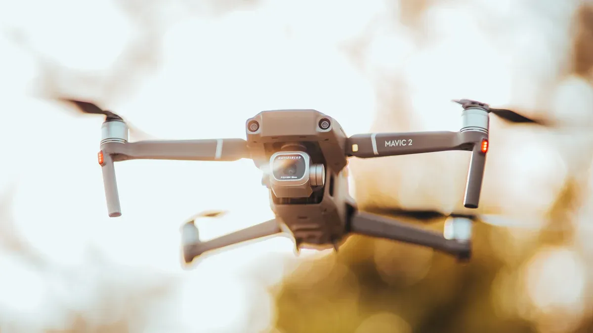
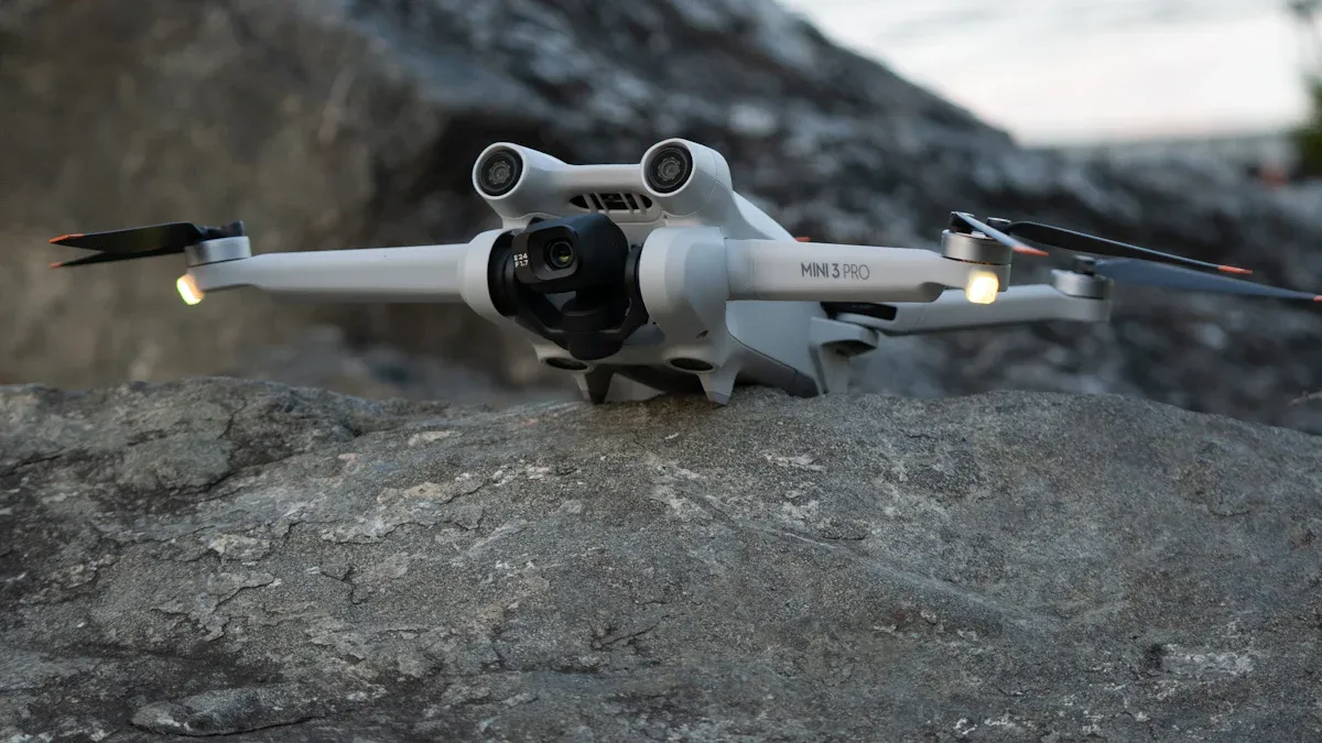
IMUs play a critical role in stabilizing drones used for aerial photography and videography. These sensors ensure smooth flight and precise camera positioning, allowing photographers to capture high-quality images and videos. By detecting and correcting for vibrations and sudden movements, IMUs help drones maintain steady shots, even in windy conditions.
Professional-grade drones equipped with advanced IMUs can execute complex maneuvers, such as orbiting around a subject or following a moving target. This capability has made drones indispensable tools for filmmakers, real estate agents, and event organizers. The integration of IMUs with GPS further enhances their performance, enabling precise location tracking and seamless transitions between shots.
Tip: For optimal results, photographers should pair IMU-equipped drones with gimbal-stabilized cameras to minimize motion blur and achieve cinematic-quality footage.
Industrial and Agricultural Drones
In industrial and agricultural settings, IMUs enable drones to perform tasks with exceptional precision. These sensors provide real-time data on movement and orientation, allowing drones to navigate large areas and execute specific actions. For example, agricultural drones use IMUs to maintain stable flight while spraying crops or monitoring field conditions.
Industrial applications also benefit from IMU technology. Drones equipped with these sensors can inspect infrastructure, such as bridges and pipelines, by flying close to structures and capturing detailed images. The stability provided by IMUs ensures accurate data collection, even in environments with strong winds or vibrations.
The growing demand for drones in these sectors reflects the broader expansion of the IMU market. According to market reports:
-
The IMU market size in 2023 reached USD 21.74 billion, with a compound annual growth rate (CAGR) of 6.2% during the forecast period.
-
Key regions driving this growth include North America, Asia Pacific, and Europe.
-
Applications span aerospace, defense, automotive, and consumer electronics, highlighting the versatility of IMU technology.
By integrating IMUs, industrial and agricultural drones achieve higher efficiency and reliability, making them essential tools for modern operations.
Military and Rescue Operations
Drones equipped with IMUs have become indispensable tools in military and rescue operations. These sensors provide precise motion tracking and stability, enabling drones to perform critical tasks in challenging environments. IMUs enhance the reliability and effectiveness of drones, making them suitable for missions that demand accuracy and quick response times.
In military applications, IMUs contribute to the stability and navigation of unmanned aerial vehicles (UAVs). These sensors work alongside AI-driven algorithms, such as Kalman Filters, to maintain precise positioning even in GPS-denied environments. This capability allows drones to operate effectively in areas with high interference or limited satellite coverage. For example, reconnaissance drones rely on IMUs to hover steadily while capturing high-resolution images of enemy terrain. This stability ensures that data collected during missions remains accurate and actionable.
Rescue operations also benefit significantly from IMU technology. Drones equipped with IMUs can navigate through debris-filled areas or dense forests to locate survivors. By integrating data from multiple sensors, including accelerometers and gyroscopes, drones achieve enhanced maneuverability and obstacle avoidance. This capability proves invaluable during natural disasters, where traditional search methods may be hindered by inaccessible terrain.
IMUs also play a critical role in drone diagnostics. Acceleration measurements enable UAVs to identify defects with over 95% accuracy. Time-series analysis and frequency domain features help detect issues early, ensuring that drones remain operational during high-stakes missions. This diagnostic capability reduces downtime and enhances mission success rates.
-
Key Advantages of IMUs in Military and Rescue Drones:
-
Precise navigation in GPS-denied environments.
-
Enhanced stability for data collection and imaging.
-
Reliable diagnostics for maintaining operational readiness.
-
IMUs empower drones to perform complex tasks with precision, making them essential for military and rescue operations. Their ability to provide real-time data ensures that drones can adapt to dynamic conditions and deliver life-saving results.
IMUs, such as the ICM-42605, play a vital role in enhancing drone stability and motion tracking. These systems combine accelerometers, gyroscopes, and magnetometers to deliver precise motion data for navigation and control. Their integration enables drones to maintain balance, counteract disturbances, and perform complex tasks with accuracy.
The growing demand for drones in military applications highlights the importance of IMUs. For example:
|
Date |
Event Description |
|---|---|
|
January 2023 |
Ukraine allocated USD 550 million for UAV procurement for Armed Forces. |
|
September 2022 |
Russian military deployed KUB and Lancet kamikaze drones during combat operations. |
|
N/A |
Increased demand for IMUs due to military UAV applications. |
As drone technology advances, IMUs will remain a cornerstone of innovation, empowering drones to navigate diverse environments and achieve greater autonomy.
What are inertial measurement units, and why are they important for drones?
Inertial measurement units are systems that combine sensors like accelerometers, gyroscopes, and magnetometers. They provide real-time motion tracking and precise motion tracking data, enabling drones to maintain stabilization, navigate accurately, and perform complex tasks.
How do IMUs contribute to drone stabilization?
IMUs detect changes in movement and orientation using sensors. This data allows flight controllers to make rapid adjustments, ensuring drones maintain balance and positioning during flight, even in challenging conditions.
Can IMUs function without GPS in UAVs?
IMUs enable real-time tracking and control in GPS-denied environments. By integrating vision-based navigation algorithms, they provide reliable positioning and motion tracking technology, making them essential for autonomous UAV operations.
What role does sensor fusion play in IMU functionality?
Sensor fusion combines data from accelerometers, gyroscopes, and magnetometers within an inertial measurement unit. This integration enhances real-time motion tracking and precise motion tracking, ensuring accurate control and navigation.
How do IMUs improve drone control during flight?
IMUs provide real-time data on movement and orientation. This information helps flight controllers adjust motor outputs, ensuring drones respond accurately to commands and maintain stabilization during maneuvers.
See Also
Utilizing ADXL357BEZ for Motion Sensing and Stability Solutions
Integrating AEAT-8800-Q24 to Boost Robotics Functionality
Ensuring Excellence in Electronics Through Advancing Technology
RV1126 Fuels AI-Driven Edge Computing for Robotics
MAX8647ETE+T: Improving Display Quality in Smartphones